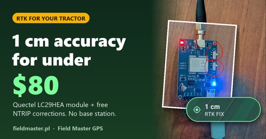
RTK guidance usually means a five-figure price tag and your own base station on the barn roof. Today you can get the same centimetre-level accuracy in your tractor for under $80: a low-cost Quectel LC29HEA RTK module, an Android phone or tablet and free RTK corrections over the internet. No base station, no subscription.
See it working in the field: RTK Fixed in a tractor
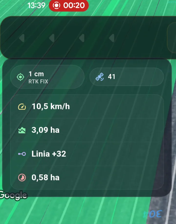
Real footage from the field: the app keeps the tractor on the line and gives steering corrections down to the centimetre. No simulation, just a working tractor with a low-cost Quectel LC29HEA RTK module.
High-end guidance accuracy for a fraction of the price
Factory RTK guidance systems are expensive mainly for two reasons: a costly GNSS receiver and a paid correction source (a subscription or your own base station). Both problems are gone:
- Receiver: the Quectel LC29HEA is a dual-band GNSS module (L1 + L5) with RTK support. On AliExpress it costs under $80.
- Corrections: many regions offer free RTK corrections over NTRIP, so you do not need your own base station.
- Screen and guidance: an Android phone or tablet running Field Master GPS, which connects to the correction server (NTRIP) and forwards the data to the module.
This is probably the cheapest possible way to get RTK in a tractor. Most importantly, the accuracy has been tested in the field by our users, and they love it. Farmers worked at full accuracy even when the nearest measuring mast stood about 40 km (25 miles) from the field – below we explain why that works.
Shopping list: RTK for under $80
| Item | What for | Notes |
|---|---|---|
| Quectel LC29HEA module | RTK GNSS receiver | under $80 |
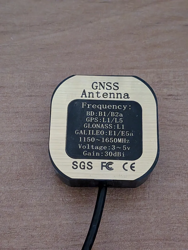
| L1/L5 GNSS antenna | Receiving satellite signals | Dual-band, ideally magnetic for the cab roof. Some module bundles include it. |
| USB-C → USB-A cable | Power and data from the module | A regular charging cable that also carries data. |
| OTG adapter USB-A → USB-C | Plugging into your phone or tablet | A few dollars. |
| USB hub with charging (optional) | Charger or power bank while working | Must support charging and data transfer at the same time. |
| NTRIP account | RTK corrections over the internet | free in many regions |
The module is sold on AliExpress in several variants. You can look for a version bundled with an antenna or one with a Bluetooth module. The Bluetooth version talks to your phone without a data cable, but it still needs power.
How to connect the RTK module to a phone or tablet
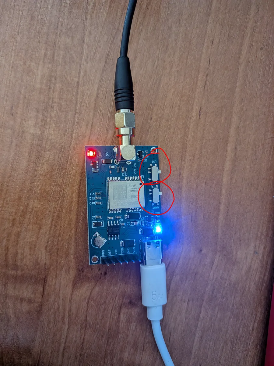
The board has two small slide switches labelled USB and UART (circled in the photo above). You have to move them so the module sends data through the USB-C port. With the factory setting your phone may detect the module but never receive a position. This is the most common reason for “it doesn’t work”.
For the module to get proper power, do not plug it straight into the phone with a USB-C ↔ USB-C cable. Do this instead:
Tip: if you want to charge the phone from a car charger or power bank while working, get a USB hub that supports charging and data transfer at the same time. Plug the module and the power source into the hub, and the hub into the phone.
- Screw the antenna onto the SMA connector and place it as high as possible, ideally on the cab roof, with a clear view of the sky.
- In the Field Master GPS settings, choose the USB GPS/NMEA source and allow the app to access the USB device.
- In the RTK corrections (NTRIP) card, enter your correction service details, tick Enable RTK corrections and connect.
- After a moment the status changes to RTK Float and then RTK Fix. From then on you have centimetre-level accuracy.
Free RTK corrections: no base station needed
RTK needs a stream of corrections from a reference station with a precisely known position. You do not have to build one: in many places these corrections are available for free over the internet (NTRIP), and a regular mobile data connection on your phone is enough.
A reference station is a mast whose exact position is known to the millimetre. It watches the satellites all the time and measures how far off their signal is at this very moment – that difference is the correction.
You do not connect to a single mast, though. Your phone sends your own position to the network server (that is the GGA message you leave switched on in the app), and the system combines measurements from several nearby masts into a virtual station placed right next to your tractor. You get corrections as if a mast stood at the edge of your field.
That is why the distance to the nearest mast stops being critical. With a single base station accuracy would drop with every kilometre. On a network with a virtual station our users keep full accuracy even when the closest physical mast is 30-40 km away.
In our tests we connected to the mountpoint RTN4G_VRS_RTCM32 of the Polish ASG-EUPOS network – that is exactly the virtual station (VRS) service in RTCM 3.2 format. Look for a mountpoint with VRS in its name at your provider. The Polish station map is here.
- Government networks: several US state departments of transportation run free RTK networks (registration required). In Poland, the national ASG-EUPOS network is free.
- Community networks: open projects such as Centipede or the public RTK2go caster share base stations free of charge.
- Your local surveying authority or agricultural dealers often know the nearest free or low-cost NTRIP service.
From your provider you only need: server address, port, mountpoint, username and password. Keep sending your position (GGA) to the server enabled so network services can calculate corrections for your location. Our users have reached RTK Fixed even about 40 km from the reference station.
RTK that pays for itself after a few passes
Without RTK every next pass is guesswork: a 30–50 cm overlap here, an unsprayed strip there. With centimetre-level accuracy that is gone. Here is an example for a sprayer:
| Assumption | Value |
|---|---|
| Field | 20 ha (about 50 acres) |
| Chemical cost per hectare (one application) | about $40 |
| Chemical cost for the whole field (one application) | 20 ha × $40 = $800 |
| Typical overlap without precise guidance | about 5% of the area, i.e. 1 ha |
| Wasted chemicals per application | 5% of $800 = about $40 |
| Module cost (<$80) paid back | $80 ÷ $40 = after about 2 applications |
Add less fuel and time, more even seeding and fertilizer passes and a less tired operator. At this price, low-cost RTK pays for itself after just a few passes, and then it simply saves you money.
Field Master GPS offers A-B line and curve guidance, coverage mapping, field management, treatment history and RTK support over USB and Bluetooth. Download the app, connect the module and check the accuracy in your own field.
Frequently asked questions about low-cost RTK
Can you really get RTK for under $80?
Yes. The Quectel LC29HEA module costs under $80 on AliExpress, many correction networks are free, and an Android phone or tablet works as the display. You only need to add an antenna (if it is not bundled), a cable and an OTG adapter.
Do I need my own RTK base station?
No. Corrections come over the internet (NTRIP) from existing reference stations. The app downloads them and forwards them to the module.
Will this work if I farm far from any town?
Yes. A correction network calculates a virtual station right next to your tractor from several surrounding masts, so you do not need one nearby. Our users keep full accuracy even when the closest mast is around 40 km away. What matters more is a clear view of the sky and a working mobile connection.
The module is connected but the app gets no position. What should I do?
First check the USB and UART switches on the board: they must be moved. Then check the cable order: module USB-C, cable to USB-A, OTG adapter USB-A to USB-C, phone. Also make sure the cable carries data, not just power.
Can I charge my phone while working?
Yes. Use a USB hub that supports charging and data transfer at the same time. Connect the module and a charger or power bank to the hub, and the hub to the phone.
Is there a wireless Bluetooth version?
Yes, AliExpress sells module variants with Bluetooth. Field Master GPS supports RTK receivers over USB and Bluetooth, and NTRIP corrections work with both. The module still needs power.
Where can I get free RTK corrections?
It depends on your country: several US state DOT networks are free, community networks such as Centipede and the public RTK2go caster share base stations for free, and in Poland ASG-EUPOS is free. You only need mobile data on your phone.
Want to learn the basics first? Read our guide to agricultural GPS guidance for tractors.